
Introduction
Modern drones are no longer limited to remote-controlled flight. Advances in embedded systems, navigation algorithms, and sensor technologies have enabled the development of autonomous drones capable of flying independently with minimal human intervention. These drones rely heavily on GPS and sensor fusion to maintain stability, determine position, and navigate complex environments.
Autonomous drones are widely used in:
- Agriculture
- Surveillance
- Delivery systems
- Disaster management
- Mapping and inspection
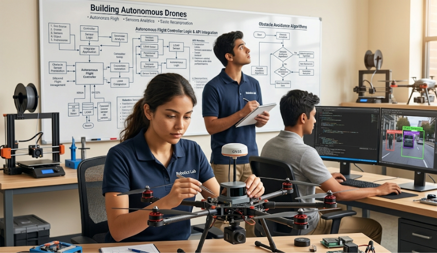
Core Components of an Autonomous Drone
Flight Controller
The flight controller acts as the drone’s brain. It processes sensor data and controls the motors to maintain stable flight.
Popular controllers include:
- Pixhawk
- ArduPilot-based systems
- Betaflight controllers
GPS Module
GPS provides global positioning information such as:
- Latitude
- Longitude
- Altitude
- Ground speed
This enables the drone to:
- Follow predefined routes
- Return to home automatically
- Maintain position during hovering
However, GPS alone is not always accurate enough for stable autonomous flight.
Inertial Measurement Unit (IMU)
The IMU contains:
- Accelerometers
- Gyroscopes
These sensors measure:
- Acceleration
- Angular velocity
- Orientation changes
The IMU provides fast motion data but tends to drift over time.
Magnetometer
The magnetometer functions as a digital compass and helps determine the drone’s heading relative to Earth’s magnetic field.
Barometer
The barometer measures atmospheric pressure to estimate altitude more accurately than GPS in short-range vertical movement.
What Is Sensor Fusion?
Sensor fusion combines data from multiple sensors to produce more accurate and reliable information than any single sensor alone.
For example:
- GPS provides accurate global position but updates slowly
- IMU provides rapid motion updates but accumulates errors
By combining both:
- Position becomes more stable
- Navigation becomes more reliable
Sensor Fusion Algorithms
Kalman Filter
One of the most widely used algorithms in autonomous drones.
Functions:
- Combines noisy sensor data
- Predicts future states
- Corrects estimation errors
The Kalman Filter continuously updates:
- Position
- Velocity
- Orientation
Complementary Filter
A simpler alternative used in lightweight systems.
It combines:
- High-frequency IMU data
- Low-frequency GPS or compass data
Autonomous Flight Features
Waypoint Navigation
The drone follows predefined GPS coordinates automatically.
Applications:
- Land surveying
- Agricultural spraying
- Infrastructure inspection
Return-to-Home (RTH)
If communication is lost or battery levels become critical, the drone automatically returns to its launch position using GPS.
Obstacle Avoidance
Additional sensors such as:
- LiDAR
- Ultrasonic sensors
- Stereo cameras
help detect and avoid obstacles during flight.
Challenges in Autonomous Drone Design
GPS Signal Loss
Urban environments or indoor areas may weaken GPS signals.
Solution:
- Visual positioning systems
- SLAM (Simultaneous Localization and Mapping)
Sensor Noise and Drift
Sensors are never perfectly accurate.
Solution:
- Calibration
- Sensor fusion algorithms
Power Consumption
Autonomous drones consume significant power due to onboard processing and sensors.
Solution:
- Efficient motor control
- Lightweight hardware design
Environmental Conditions
Wind, rain, and electromagnetic interference can affect stability and navigation.
Applications of Autonomous Drones
Agriculture
- Crop monitoring
- Precision spraying
- Soil analysis
Delivery Services
Companies are exploring autonomous drones for package delivery.
Surveillance and Security
Used for:
- Border monitoring
- Traffic observation
- Disaster response
Mapping and Inspection
Drones can inspect:
- Power lines
- Pipelines
- Construction sites
Future Developments
Emerging technologies are improving drone autonomy through:
- AI-based navigation
- Computer vision
- Swarm coordination
- 5G communication
Future drones may operate collaboratively without direct human supervision.
Key Insight
Autonomous drones achieve reliable flight not through a single sensor, but through intelligent coordination of multiple sensing systems.
Conclusion
Building autonomous drones requires the integration of embedded hardware, navigation systems, and advanced algorithms. GPS provides global positioning, while sensor fusion ensures stable and accurate movement. As technology advances, autonomous drones are expected to become more intelligent, efficient, and essential across numerous industries.